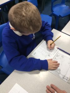
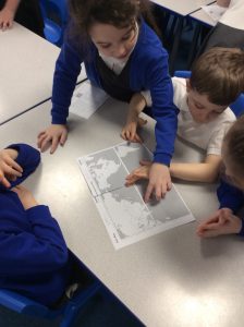
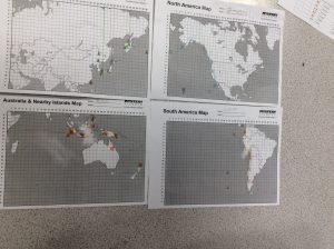
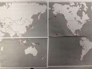
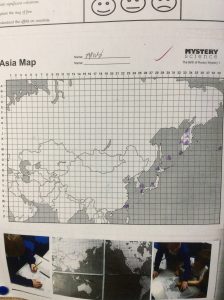
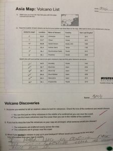
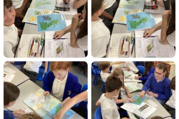
This week Year 3 have been learning about the ring of fire. In groups of four, we each had a different area/ section of a map, on which we used co-ordinates to plot volcanoes that have erupted in the last few hundred years. Once each member had completed their individual map, we put the four pieces together. From this, we found out that the majority of the volcanoes are in groups around the coast and we spotted the ring like shape that creates ‘The Ring of fire’

Locating rivers around the world
During our Geography lesson, we used atlases to locate and identify rivers from around the world, helping us develop our map-reading skills and improve our understanding of global geography. Report Anything Issue: * Problem Read more
0 Comments